The power of digital systems during crisis
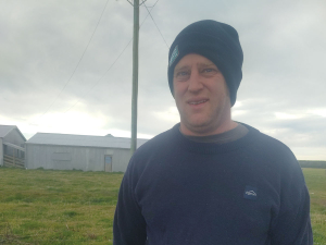
Digital systems will come into their own with COVID-19 restrictions, says James Watson of TracMap.


 increase font size

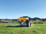
FARMERS COULD extract 20% more value from their fertiliser spend by using their fertiliser contractors' TracMap TracLink system more effectively, says the company's managing director Colin Brown.
He spoke to 50 drystock and dairy farmers at a Dargaville seminar organised by Northland fertiliser supplier and spreading contractor KD Spreaders.
Brown pins the increase to variable spreading rate maps. Made possible by cloud-stored farm mapping software such as TrackMap's TracLink system, variable spreading rate maps match fertiliser application to topography and stock behavior, rather than 'blanketing' a farm or paddock.
Brown argues that because stock stay on hillsides only long enough to graze, they tend to carry the nutrients used to grow that pasture down to 'camps' on flats.
As a result, nutrient and mineral levels on hillsides tend to drop so low that high-producing rye and clover cultivars are unable to grow and the sward reverts to browntop, kikuyu or other low feed-value, low nutrient-requirement grass varieties.
You see a similar result on dairy farms: greater pasture growth at the gate and trough parts of a paddock where cows tend to congregate, Brown says.
Fertiliser applied at blanket rates set for an entire farm don't go far enough in addressing the shortfall. While an average application rate of 230kg/ha phosphate/season is often more than enough for most farms, it doesn't go far enough to meet the nutrient needs on hillsides.
Brown recommends reducing the amount of fertiliser applied on flats and in stock camps, and spreading it instead on the hills. His TracLink system facilitates this, allowing a farmer to quickly and easily send detailed maps specifying different fertiliser application rates within paddocks to his fertiliser rep.
Developed using information from Google Earth, the online platform allows a farmer to set out a digital map of his farm, providing the fertiliser spreader with unprecedented data. This is done by first accessing the cloud-hosted system through a computer browser and plotting boundaries, fences and various farm zones on the Google Maps powered interface.
Plotting a basic map is said to take only one or two hours, even for a novice using a slow internet connection.
Plotting a more detailed variable rate map takes more time, Brown says, and may need the help of a more tech-savvy neighbour. "There's no shortage of teenagers you could pay a hundred bucks to work a mouse while you show them where to click."
With 77% of the country's fertiliser spreaders using a TracMap GPS system, it remains only for farmers to digitally map their farms and spread fertiliser strategically. Then phone the contractor.
The company has TracLink improvements in process, due for release this month. "It will make plotting farm maps much easier." Tel 0800 87 22 62
www.tracmap.co.nz
Digital systems will come into their own with COVID-19 restrictions, says James Watson of TracMap.

Farmers can now order, initiate and record fertiliser and spray applications on their farms at the click of a button.
DUNEDIN-BASED agricultural GPS business TracMap has extended its market further into Australia, signing a major new supply agreement with Kagome Foods, the country's largest tomato grower.
ORDERING AND tracking fertiliser and spray is made easier for farmers and contractors using a new system from TracMap NZ Ltd, the agricultural GPS company.

South Waikato farmer Bas Nelis is always interested in fine-tuning his business to improve results.
On a farm in Tikorangi, North Taranaki, Brent Stevenson is sharemilking 1,400 cows.
Associate Agriculture Minister Mark Patterson says his party – NZ First - isn’t opposed to the “trade element” of a free trade deal with India.
The managing director of a company seeking to build a solar farm in Canterbury says receiving fast-track approval is a “really positive outcome”.
Retiring MP and dairy farmer Mark Cameron is blasting the Green Party for proposing to ban the use of synthetic fertiliser and cutting cow numbers.
A huge reduction in ACC claims from on-farm accidents over the last five years is due to thousands of small, practical decisions being made in sheds, yards, paddocks and around kitchen tables across the country, says Safer Farms ambassador Lindy Nelson.


OPINION: Central Hawke's Bay farmer Mark Warren recently told the Hawke's Bay Times it's time for a conversation about allowing…
OPINION: A nation that relies as heavily as NZ does on functional global shipping lanes will have to do its…
![]()