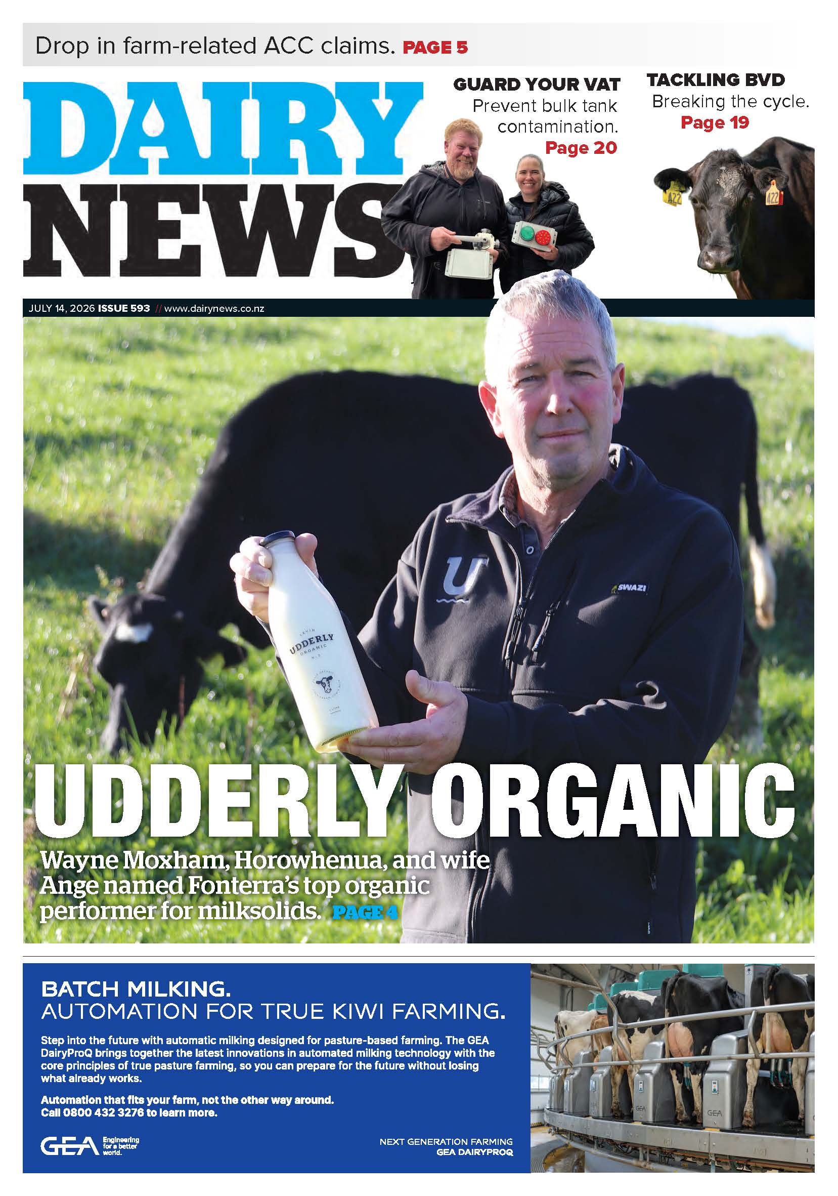
Cyclone Vaianu Brings Heavy Rain, Flooding Across NZ
Cyclone Vaianu is continuing its track south towards the Bay of Plenty, bringing with it destructive winds, heavy rain, and large swells, says Metservice.


 increase font size
Heavy rain, snow and strong winds will continue to take their toll on parts of the country over the weekend, says MetService.
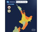
The low-pressure system that has wreaked havoc on the west coast of the South Island is set to continue travelling north over the next couple of days.
MetService says that Hokitika airport reported almost 200mm of rainfall in 24 hours, while figures in the ranges to the east were higher still. On the other side of the Southern Alps, large parts of Central Otago and Canterbury received a covering of snowfall.
Severe weather warnings and watches remain in place for many parts of the country and as rain spreads northwards, it looks like a wet and windy start to the weekend for the North Island.
The deep area of low pressure that generated severe weather across the South Island pulls away to the south, leaving a cool southerly feed of air over the region. Meanwhile, rain and strong winds will continue to push up onto the North Island.
Severe weather warnings remain in place for Wellington, the Kapiti coast and across into Wairarapa. While, parts of Taranaki and the central Plateau will receive more rain on today and into Saturday, with snow likely to return to the Desert road and the Volcanoes.
MetService forecasts suggest that rain will continue to track northwards during Saturday accompanied by strong and gusty northwesterly winds. Areas from Waikato to Northland and the Bay of Plenty are likely to catch the final throws of the storm on Saturday. After a wet Saturday in Auckland, the weather is set to improve for Sunday, but still a few showers are left to clear.
Although there has been plenty of talk of cold weather over the last few days, the temperatures across the eastern parts of the North Island are likely to remain very mild for this time of the year says MetService. Temperatures in Napier and Hastings are predicted to climb into the high teens and even reach 20C on Saturday.
"The start of next week sees the cold weather push right across the country and temperatures across much of New Zealand will really struggle during the first few nights of next week," says MetService meteorologist John Law.
The return of cold air plus a building high pressure are likely to bring widespread frosts across both the North and South Island. "At this stage, temperatures about central and eastern parts of the South Island for Tuesday morning look to drop well below freezing, with severe frosts forecast in places," says Law.
Cyclone Vaianu is continuing its track south towards the Bay of Plenty, bringing with it destructive winds, heavy rain, and large swells, says Metservice.

The government has announced a major restructuring of the country's seven crown research institutes (CRIs), which will see them merged into three public research organisations (PROs).
Merging MetService and NIWA is the right thing to do, but independent weather forecaster Phil Duncan of WeatherWatch says he isn’t sure a merged entity will boost rural weather forecasting.
MetService meteorologist James Millward says the country’s weather patterns are now on a much more even footing.
Metservice meteorologist James Millward says the country’s weather patterns are now on a much more even footing.


The Ministry for Primary Industries (MPI) says no new cases of H5 bird flu have been detected following a case found earlier this week.

Two months after unveiling a major upgrade to its beef product, Halter says its farmers are on track for major production gains and additional grass growth.
New Zealanders are being urged to be alert following a confirmed positive case of H5 bird flu this week.
With a third of NZ dairy farmers still running outdated refrigerants, the country's largest farm refrigeration company says the opportunity for quick, meaningful emissions gains has never been clearer.
OPINION: Farmers are being put on notice by the Green Party.
As dairy farmers lock in plans for the upcoming mating season, a partnership between Fonterra and Silver Fern Farms has been formed with the aim of making it simpler to create additional value from calves not entering the replacement herd.


OPINION: Central Hawke's Bay farmer Mark Warren recently told the Hawke's Bay Times it's time for a conversation about allowing…
OPINION: A nation that relies as heavily as NZ does on functional global shipping lanes will have to do its…
![]()