Founded in New Zealand in 2006, over the following 20 years, Tabula (formerly TracMap) has evolved to develop technology that helps organisations plan, coordinate and prove complex field operations.
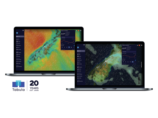
The latest addition to its field operations platform is a weather functionality system, giving teams access to current conditions, forecasts and visual weather data within the same map they use to plan and manage work.
At the centre of the release, a new compact weather widget provides an at-a-glance view of current conditions for the area being viewed, and as users browse the map, the weather information updates with them. This allows teams to move between fields, job sites or other working areas and quickly check the conditions at each location, without switching between different systems.
Expanding the widget provides greater detail on current conditions, alongside a forecast for the next 24 hours. Users can toggle between six interactive visual layers including temperature, humidity, wind, wind gusts, rain and Delta T and view them directly on the map.
Each layer provides a visual representation of conditions across the map, making it easier to identify differences between locations. Wind can also be overlaid with the other weather layers, showing wind direction alongside conditions such as rainfall, humidity or Delta T.
For weather-sensitive work such as spraying, the Delta T layer provides important context, helping teams understand how conditions vary across different locations when planning work.
Weather on Tabula Live is powered by Open-Meteo, with information provided to support work planning and decision-making. Customers should continue to carry out appropriate checks when assessing conditions for weather-sensitive work and follow relevant compliance and health and safety requirements. Pilots should continue to use an approved meteorological product for flight planning.
Visit www.tabula.live