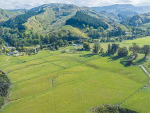
Nassella Tussock (Nassella trichotoma) occurs in drought-prone grasslands, mainly in the Canterbury and Marlborough regions.
It is unique in that it is the only weed in New Zealand to have had its own Act of Parliament, the Nassella Tussock Act 1946.
Historical control programmes have substantially reduced the weed’s populations from what were, in some cases, virtual monocultures of up to 35,000 plants per hectare of the tussock, which is unpalatable for livestock.
Although eradication has proven elusive, a 17-year study in Canterbury, published in 2016, showed that the population density of the weed across 878 invaded farms in the Hurunui district of North Canterbury is stable at about 15 plants per hectare. Grubbing of the plants (digging out) before seeding each year – the management tactic practiced on these farms – has been responsible for maintaining this ‘equilibrium’, according to onfarm experiments and modelling.
Left uncontrolled, the modelling indicates that the weed’s populations will increase, potentially reaching the economically damaging monocultures of the past which in some cases forced farmers to abandon their properties.
A new app, developed by AgResearch with funding from the Ministry of Business Innovation and Employment in collaboration with Environment Canterbury, provides a tool to visualise a range of grubbing strategies. The app deploys a population model that counts the number of nassella tussock plants in summer and winter in each of seven different life stages of the tussock and keeps track of their contribution to the total tussock population over successive years.
AgResearch principal scientist, Graeme Bourdôt, who with colleagues has spent decades researching nassella tussock, says this app follows in the path of another similar tool for giant buttercup which AgResearch developed to support dairy farmers in weed management decisionmaking.
“The nassella tussock app draws on decades of research into how nassella tussock plants grow and contribute to the population growth of the weed in dryland sheep and cattle pastures,” he says.
“It enables the user to see how different frequencies, intensities and seasons of grubbing will affect the future number of nassella tussock plants on a block of land and on an adjacent block of land.”
Environment Canterbury Biosecurity Officer Matt Smith says the app is a great way for land occupiers to model different control scenarios on their properties. “It clearly demonstrates that annual control is the best method to decrease or maintain plant numbers. Applying different scenarios may also help convince some properties to move towards different control regimes.”
The app can be found athttps://nassella-tussock-population-model-nz.agresearch.co.nz/


