An unsettled end to 2023 has given way to a milder and drier January for most regions.
A three year La Niña has not been easy to shake off and bursts of strong westerly winds gave way at times to cloudier and cooler conditions as spring moved into summer. Global temperatures and sea surface temperatures have remained well above normal and these markers of climate change are making El Niño in 2023-24 a little more challenging to understand. By the numbers this is a strong El Niño, but the influence of other climate drivers such as the Madden-Julian Oscillation, Indian Ocean Dipole, and the Southern Annular Mode influence weather in the southern hemisphere. Global temperatures in 2023 were 1.5°C warmer than preindustrial times.
El Niño is likely to start weakening in autumn and there is growing consensus that Southern Oscillation Index conditions will return to neutral over winter. There are some murmurings that La Niña may return late in 2024. If this happens it would be the fourth year in five that La Niña has occurred.
Extreme heat and the frequency of weather:
There have been extreme weather headlines in the news in Aotearoa and overseas. Record breaking or near record temperatures fill our newsfeeds and social media timelines on a daily basis. This increase in temperature means the potential for increased water vapour in the atmosphere and a subsequent increase in heavy rain events when conditions become suitable. This increase in water vapour also increases dewpoints and humidity, even when conditions are dry.
Climate change is the main driver of these weather events, and it is their frequency that brings large social and economic challenges. Since I was young, I have been fascinated with extreme temperatures in New Zealand and around the world. From reading the previous day’s temperatures in the newspaper as a schoolboy, to having my own network of weather stations today, I have seen temperature patterns change over the past 40-plus years.
A typical Automatic Weather Station (AWS) in New Zealand will measure a range of conditions, including air temperature, rainfall, sunshine, wind speed, and air pressure. From these measurements we can monitor and compare our daily weather, months, seasons, and years. Temperature and rainfall records can go as far back as the 1700s in some countries. In New Zealand accurate measurement of the weather goes back to the mid-1800s. Each year the variability in our weather means that new temperature records are set at different locations. The long-term range of measurements showcase how variable our weather can be. For example the coldest temperature recorded was -25.6°C at Ranfurly in 1908 and the warmest was 42.4°C at Rangiora in 1973.
Climate change does not mean that we will see temperature records that sit at the very extreme of our range of measurements being broken consistently – although it can. What climate change brings is an increase in the frequency of weather that is outside of the climatic norm. For example, it is quite normal for temperatures in Blenheim to exceed 30C at least once every January, even though the average maximum temperature is 24C. However, in a warming climate we may find that the number of days exceeding 30C or even 27C increase, and the average daily maximum temperature increases. In other areas we may find that changing weather patterns bring milder nighttime temperatures.
Extreme temperatures can be very stressful for living things. However, maximum temperature alone is not the best measure of heat stress in humans. A better measure of heat stress is the wet bulb temperature – when humidity is low and wet bulb temperatures are low a body can endure higher temperatures for longer periods. When the wet bulb temperature increases it become more difficult for a body to cool through perspiration and the risk of heat stress increases in a shorter period of time. This is why in parts of the upper North Island, summer days where humidity is high can feel so unpleasant, even when the air temperature is below 30C.
Outlook for February and March:
Gisborne/Hawke's Bay
Warm north to northwest winds are likely to return at times and this should keep temperatures running above average. Sunshine totals should be near or above average. Rainfall totals are likely to be below average, but there is always a risk of an ex-tropical low bringing rain to the east coast of the North Island in late summer and early autumn.
Wairarapa
West to northwest winds will be stronger at times and this is likely to continue to dry the region in February and March. Dry periods are likely but there may be some rain from any low-pressure systems that move southwards out of the tropics.
Nelson
Temperatures continue to run above average for the remainder of summer and into autumn. Rainfall totals may run below average but could increase with active fronts moving in from the west. Northwest winds are likely to become more frequent and quite breezy into March.
Marlborough/North Canterbury
Temperatures remain above average and wind speeds are likely to remain stronger than average. More frequent northwesterlies are possible from late February or early March. There is an increased chance of hot 30C days continuing into autumn. Marlborough and Canterbury may see some rain under strong north to northwest flows, but overall rainfall is likely to be below average with an increased chance of prolonged dry spells. Cooler southerly changes may increase the risk of heavy localised rain.
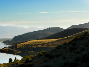
Central Otago
Temperatures are likely to be remain above average. Northwest winds may strengthen in March and there is a risk of cooler southwest changes bringing some chilly mornings by the end of March.
James Morrison runs Weatherstation Frost Forecasting: weatherstation.net.nz


