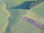
Otago Regional Council to launch winter flyovers
Otago Regional Council is set to begin its annual winter farm flyovers in the next three weeks.
 increase font size
 Otago Regional Council says it has upgraded its online consent mapping tool to be more farmer-friendly.
Otago Regional Council (ORC) has upgraded its online consent mapping site in a move designed to make the service more farmer-friendly.
The map, Consents in Otago, now includes a property-by-address, legal description or consent number search function, satellite imagery similar to Google Maps, plus named waterways, a polygon/draw tool and also a print button, says Alexandra King, ORC team leader consents.
“It’s now much more user friendly for farmers who’re working through the mapping part of their applications, specifically intensive winter grazing plans,” she says.
King says the tool allows farmers to easily identify and measure blocks throughout their farms, and help them in identifying risk areas/sensitive receptors on-farm such as critical source areas, waterways, wetlands or water bores.
The map identifies which catchment the farm is within and can also measure distances, she says.
In general, the map can also provide surface and ground water allocation availability, can locate consented activities and is useful in also identifying neighbouring consents.
Otago Regional Council is set to begin its annual winter farm flyovers in the next three weeks.

OPINION: A reader recently called out the Hound for not giving Federated Farmers enough credit for taking Otago Regional Council to task on its dodgy rule changes.
OPINION: The Otago Regional Council needs to be honest about what the new proposed freshwater rules might mean for our community and how much it could cost local ratepayers.
Federated Farmers is calling for transparency from Otago Regional Council amid a debate over proposed freshwater rules.
Applying effluent to saturated soils is prohibited, and if a farmer is found to be in breach of this rule, they could face enforcement action.


Wool Impact and ASB have signed a new partnership with the bank set to provide financial backing to support the revitalisation of New Zealand's strong wool industry.

OPINION: Farmers have been clear: it is getting harder, not easier, to find and keep good people.
Last week marked New Zealand Sign Language Week and a South Canterbury tanker operator is sharing what it's like to be deaf in a busy Fonterra depot.
As fuel and fertiliser prices rise and with uncertainty in the future, farmers are being urged to go over their budgets with a fine-tooth comb.
Federated Farmers says reforms of local government announced last week will be music to farmers' ears.
Hinehou Timutimu, the 2026 Fonterra Dairy Woman of the Year, says she feels privileged to have won the award.